Electronic ticket for entry and exit to the Dominican Republic 2025 Now you can record your entry and exit data digitally It …
Landscapes of the Dominican Republic
The Dominican Republic is known to have the most diverse topography for a single nation in the Caribbean region. You can go from a sandy beach to a cool, mountainous town over 500 meters (1,700 feet) above sea level in less than three hours. The country’s coastline is no secret–racking up over 1,600 kilometers (1,000 miles) in total, with hundreds of accessible, breathtaking beaches. More surprisingly, DR is flanked by a series of grand mountain ranges, the most important of which–the Cordillera Central–is home to the Caribbean’s highest peak: Pico Duarte, sitting at 3,087 meters (10,128 feet).
With 25% of the land consisting of protected areas, most of which are easily accessed, there are a myriad of reasons to venture off the beach. Explore lush valleys, cloud forests, national parks on and off shore, rivers leading to waterfalls, offshore cayes where turtles nest, ancient Taino caves shrouded in thick rainforest, or pine forests with near zero temperatures. Discover natural wonders like Lago Enriquillo, a saltwater lake so large it surpasses the size of Manhattan, home to American crocodiles and sitting at 40 meters (138 feet) below sea level, the lowest point in the Caribbean.
It won’t take long to find your favorite Dominican landscape, after the beach.
NATIONAL PARKS
The Dominican Republic is home to 29 national parks. Located all around the country–from the southwest to the north, east, and center–these lush areas are as much of a treasure as the DR’s multitude of sandy stretches. Thanks to the Ministry of Environment‘s active engagement in upgrading and preserving all national parks and natural resources, there’s never been a better time to explore one of our most stunning outdoors on an excursion.
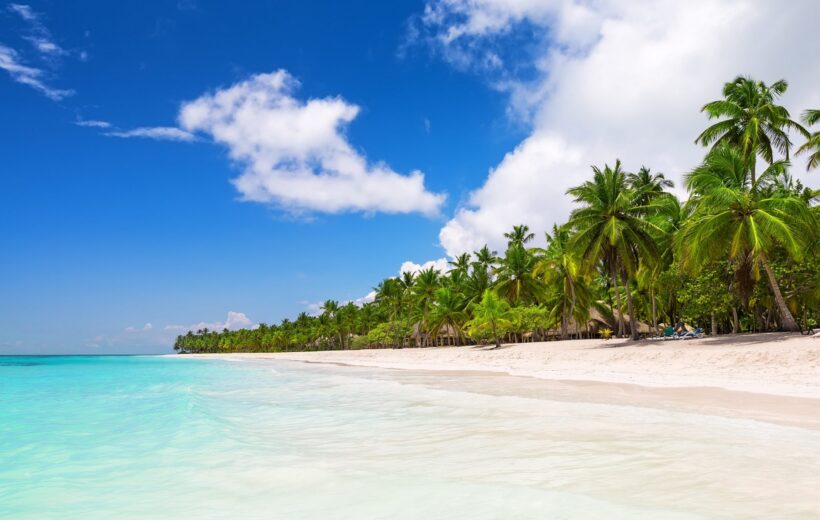
Near the areas of Punta Cana, La Romana, and Bayahibe, visit the Cotubanamá National Park –or Parque Nacional del Este–home to impressive Taino caves, and fresh spring waters. The park includes the offshore islands of Saona, the most important turtle-nesting site in the DR, Catalina, and the sandbank of Catalinita, teeming with coral reefs and frigate bird colonies.
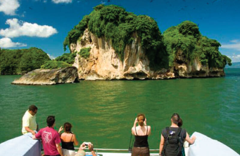
Off the coast of Samaná, Los Haitises National Park is one of the most breathtaking sights in the country. A series of giant rocks jut out of the sea, thick mangroves thrive in surrounding waters, and brown boobies and frigate colonies fill the skies. On land, large Taino caves reveal centuries-old petroglyphs and pictographs. The park can be reached by boat from Samaná or by road from Sabana de la Mar, which makes for an even more unique adventure.
Venturing northwest will lead you to the desert-like landscape of Montecristi National Park, home to El Morro, a limestone mesa towering over 200 meters (700-feet) over the Atlantic Ocean, and affectionately dubbed by the area’s residents as the DR’s “Table Mountain.” The park includes a set of seven offshore cayes that are among the most pristine and least visited in the DR.
Near Jarabacoa and Constanza, in the mountainous center of the country, the twin José Armando Bermúdez National Park and José del Carmen Ramirez National Park are home to the majestic roof of the DR and of the Caribbean: 3,087-meters (10,128-ft) tall Pico Duarte.
Those who venture southwest will have the reward of visiting Jaragua National Park, the largest of the DR’s national parks, boasting UNESCO Biosphere Reserve status for its multiple ecosystems ranging from dry forests to cacti, home to the rhinoceros and Ricord’s iguana, approximately 400 species of flora, 130 species of birds, turtle nesting beaches, and flamingos.
RIVERS & WATERFALLS
With a multitude of mountain ranges, multiple rivers flow down the DR’s plains. The most significant river is Yaque del Norte–born out of the Cordillera Central, it rises out of Pico Duarte and extends a whopping nearly 300 kilometers (185 miles). Besides providing freshwater for irrigation and farming, the river is also part of the Cibao Valley’s main attractions. Visitors go rafting down its rapids from the town of Jarabacoa. The second most significant river body is the Yuna–formed in the central Cibao Valley, and emptying in the Bay of Samaná.
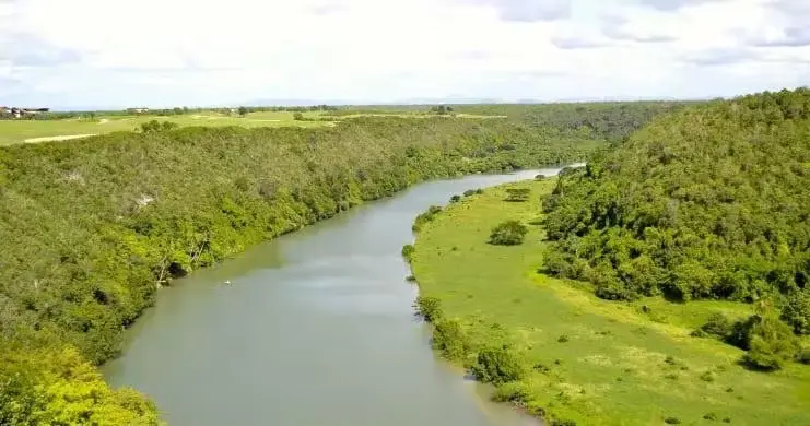
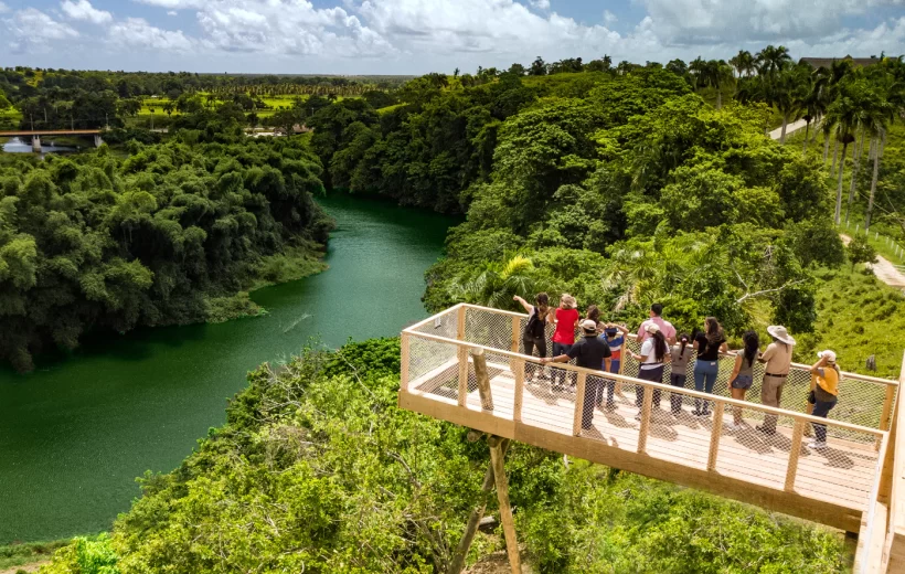
One of the most beautiful waterways in the DR is undoubtedly the Río Chavón in La Romana–you can hop on boat rides to see its magnificence up close, or kayak your way around. Río Chavón’s claim to fame includes an appearance in the feature film Apocalypse Now.
If you’re heading southwest, you’ll be greeted with an array of choices. Rivers are a chief attraction in the Barahona province. Make stops off the main highway to enjoy the fresh, emerald pools and cascades at San Rafael and Los Patos rivers, natural recreational parks set where the rivers meet the sea.
Rivers lead to waterfalls, and in the DR, they are ubiquitous–whether well known or off the beaten track. The most visited waterfalls in the country are the 27 Charcos de Damajagua in the Puerto Plata province. This impressive series of cascades tumble over a rocky landscape, emptying into deep pools that travelers can brave with a jump or a slide on smoother surface, one after the next. You’ll find plenty of lesser-known falls in Puerto Plata’s lush hills.
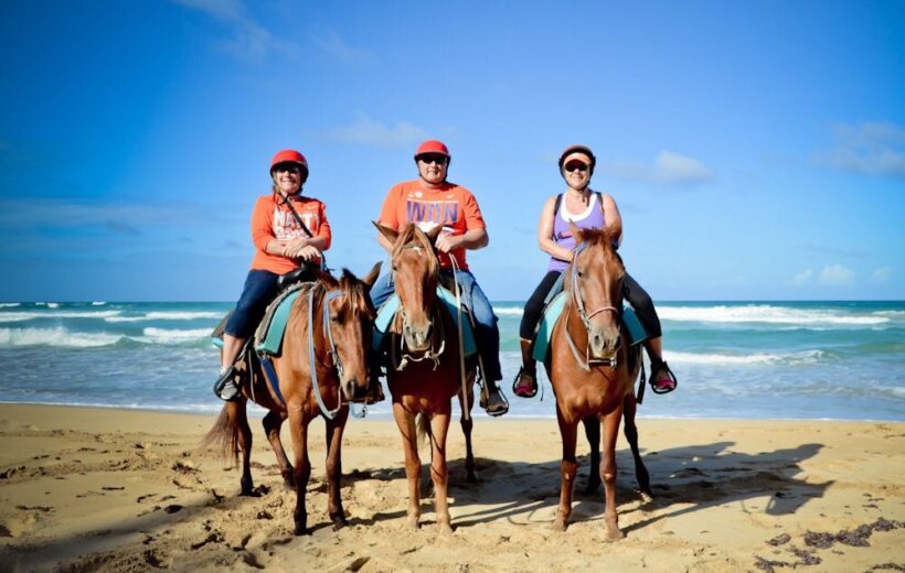
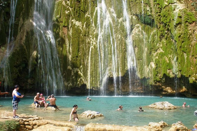
El Limón waterfall in Samaná ranks among the most impressive in the DR, rising at 30 meters (100 feet), and reached after an intense hike or horseback ride through subtropical forest.
In Jarabacoa, waterfalls are a bona fide activity–with Salto Baiguate, and Salto Jimenoa, featured in the opening scene of the Hollywood motion picture Jurassic Park.
From any point on the southeast coast, there’s easy access to the Monte Plata province, less than a couple of hours by car, and its multiple waterfall parks. The most impressive is Salto Alto, tumbling from approximately 75 feet. The 65-feet tall emerald Salto de Socoa has its entrance conveniently located right off the highway along the Santo Domingo-Samaná Highway.
ISLANDS & CAYES
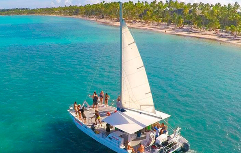
Postcard-perfect offshore islands lie off the coasts of the DR, whether it’s in the Caribbean Sea in the south, or in the Atlantic Ocean up north.
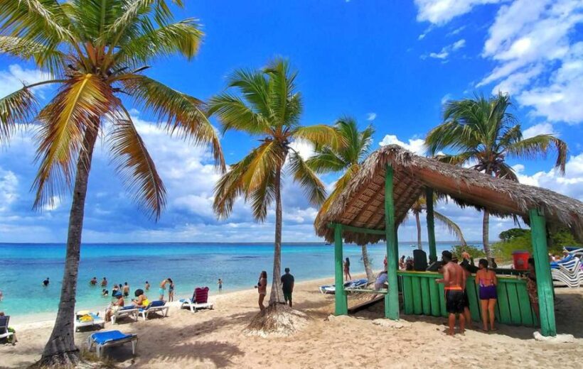
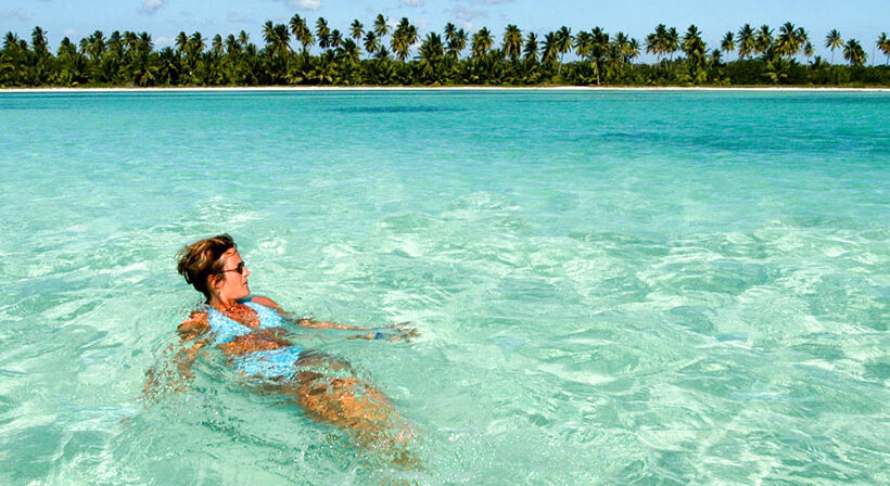
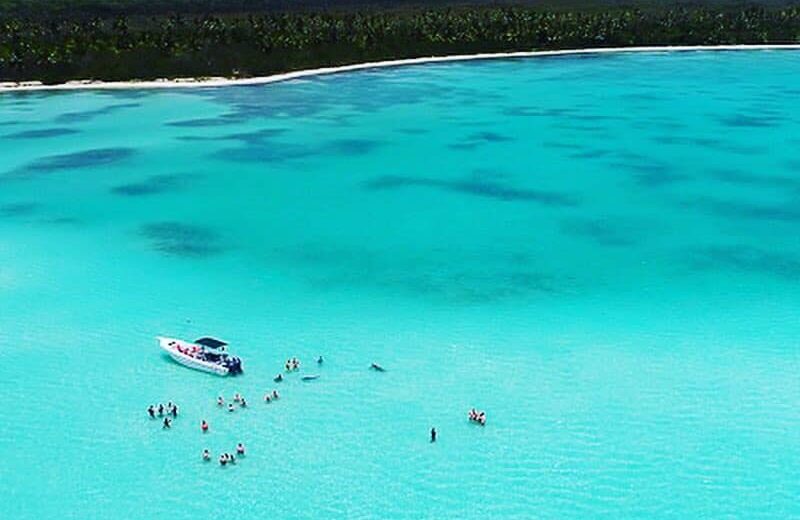
The most stunning of these are Saona and Catalina, two of three plots reached by boat from the eastern fishing village of Bayahibe, starting 19 kilometers (12 miles) offshore. Part of a protected national park, the partially-inhabited Isla Saona counts multiple white sand beaches, including La Palmilla, the largest natural pool in the Caribbean with shallow, crystal turquoise waters teeming with starfish, corals, and other tropical critters. The islands’ waters are popular with experienced divers, who come here to explore shipwrecks and caves.
Up north, Cayo Arena–or Paradise Island– is a tiny caye that resembles a sandbank, located 8 kilometers (five miles) off the shore of Punta Rucia. It attracts hundreds of day-trippers eager to spend the day out in the middle of an iridescent turquoise sea, and explore colorful fish and corals.
A set of seven off-the-beaten path isles–Cayos Siete Hermanos–are reached by boat from the shores of Montecristi, in the DR’s wild northwest. These protected plots are where colonies of egrets, pelicans, and frigate birds thrive, in addition to offering some of the most pristine snorkeling and diving locations in the DR.
DUNES
In the desert-like, dry southwest of the Dominican Republic is a surprising landscape of smooth sandy hills rising at 35 meters (114 feet). These are the sand dunes of Baní, a protected site located in the village of Las Calderas, just outside the town of Baní. Climb to the summit of the tallest dune, and the white sand Playa Las Salinas appears on one side–known for its powerful surf waves–while the other reveals the stunning Bay of Las Salinas.
LAKES & LAGOONS
There are intriguing lakes in the Dominican Republic. The most unexpected is Lago Enriquillo, stretching across two provinces in the southwest–Independencia and Bahoruco. This massive body of water is a mix of fresh and salt water, and sits 30 meters (138 feet) below sea level–the lowest point in the Caribbean. It is home to multiple bird species, as well as American crocodiles. Over the years, the lake’s water level has risen dramatically, but it makes for an unforgettable sight.
Laguna Gri Gri, on the north coast, is nearest the resort town of Cabarete, tucked in the heart of the fishing village of Río San Juan. Dense mangrove tunnels occupy its part fresh and part salty waters, while hundreds of black turkey vultures and great egrets are perched in the mangrove trees. The lagoon empties into the Atlantic Ocean.
There are also plenty of lagoons of the swimming kind to enjoy. In Punta Cana, Reserva Ecológica Ojos Indígenas–or Indigenous Eyes Ecological Reserve–is a 1,500-acre natural forest offering easy trails to a series of 12 freshwater lagoons. Laguna Dudú, in the northern town of Cabrera, consists of a series of cobalt blue and turquoise fresh water pools flowing from caves, and surrounded in tropical forest. The recreational park offers kayaking, swimming, or braving 25 foot leaps from a makeshift zipline into a giant lagoon–at your own risk.
MOUNTAIN RANGES
From north to south, the DR is flanked by five big mountain ranges– an inextricable part of its stunning scenery, providing sources of fresh water to the territory at large, and protection from major storms.
The largest and most important mountain range is often described as the DR’s spine: the Cordillera Central, stretching across the center of the country, from the border with Haiti onto Constanza, Jarabacoa, and the central region. It is home to Pico Duarte, as well as two additional summits that rank among the top five highest peaks in the Caribbean region. This is the most rugged and coldest mountain landscape you’ll find–we call it our “Dominican Alps.” The second largest range is the Sierra de Bahoruco , in the southwest region, running parallel at an elevation of about 1,500 meters (nearly 5,000 feet). Nearby, the Sierra de Neiba hides Taino Caves and freshwater springs.
In Puerto Plata, the Cordillera Septentrional stretches from Montecristi to Nagua, at over 500 meters (1,640 feet). Lastly, the Cordillera Oriental, on the eastern side of the DR, rises at under than 800 meters (2,625 feet).
Explore the Cordillera Central while in Santiago, Jarabacoa, or Constanza by going on a hike or climb, or take a drive through the hills of Puerto Plata–particularly along the Ruta Panorámica–for stunning views of the Cordillera Septentrional.
CAVES & CENOTES
CAVES
The country’s first inhabitants, the Taino, left behind numerous traces and signs of their presence. The majority of these are found in the areas where they once lived, near sources of water, and in caves where they performed rituals. Petroglyphs and pictographs can be observed in these caverns, located around the DR.
The Cotubanamá National Park, at the entrance from the village of Boca de Yuma–is home to some of the most impressive caves, including Cueva de Berna, where Taino faces are carved into the rocks. Nearby in the Punta Cana area, the recreational Scape Park was developed around a natural series of caves hugged by rainforest, one of which you can swim in.
The southwest of the DR is a cave enthusiast’s destination, with a handful of significant Taino chambers. El Pomier, in San Cristóbal, has an impressive 55 caves, not all accessible, with the highest number of petroglyphs. Las Caritas de Los Indios, in the Enriquillo area, reveals pictographs in a cave located above sea level. One of the most mystical is Cueva de la Virgen in Barahona, where the local legend says that a woman’s spirit inhabits the chambers, and can turn visitors into stone.
Up north, the province of Hato Mayor is home to the rugged Cueva Fun Fun, tucked deep in the rainforest–a partially wet underground cave, which you need to abseil into to begin exploring.
In the southeast, near Santo Domingo and La Romana, two of the DR’s most beautiful caves are easily accessed via footbridges: Tres Ojos National Park, with its iridescent blue lagoons, and Cuevas de Las Maravillas, an 800 meters (2,624 feet) cave system etched with pictographs.
CENOTES
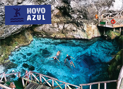
Fans of easily reached and swimmable sinkholes will rejoice at Scape Park’s Hoyo Azul, convenient to the Punta Cana resort area. At nearly 15 meters (45 feet) deep, its blue, shaded pool makes for a refreshing swim surrounded with rainforest. Also on the grounds is Cenote Indígena Las Ondas, a deep pool enclosed in an underground cavern.
Puerto Plata’s vast hills lead to plenty of sinkholes to discover, from Charchos de Damajagua to the off-the-beaten path, hilly village of Tubagua, where the forests hide a series of iridescent turquoise, spring-fed pools.
Excursions Dominican Republic
Electronic ticket for entry and exit to the Dominican Republic 2025 Now you can record your entry and exit data digitally It …
Electronic ticket for entry and exit to the Dominican Republic 2025 Now you can record your entry and exit data digitally It …

